Note From Editor/Admin. The following trip report is a contribution from one of our readers and associated Facebook group membership.
As you may, or may not be aware of, the Havasu Falls/Supai, Arizona area was devastated by a Flash Flood on July 13, 2018. In some estimates there was in excess of $250,000.00 worth of damage to the village, the campgrounds and the trail.
The area was closed off to tourists, campers, and visitors while safety concerns were eliminated, and repairs were made.
The long anticipated reopening of the area was on September 1, 2018. We expected physical alterations to the natural beauty of the area. It has occurred in the past. This is an ever changing environment. We have been hoping someone would let us know what to expect.
We wish to not only thank Jessica Rose for the time she spent compiling this information, but also for her donation of shared photos. So those of us that might not be fortunate to return soon, get an idea of what people are experiencing .
Please treat all media on this site, including Jessica’s, as copyright material. You would need her permission to use her media in any form.
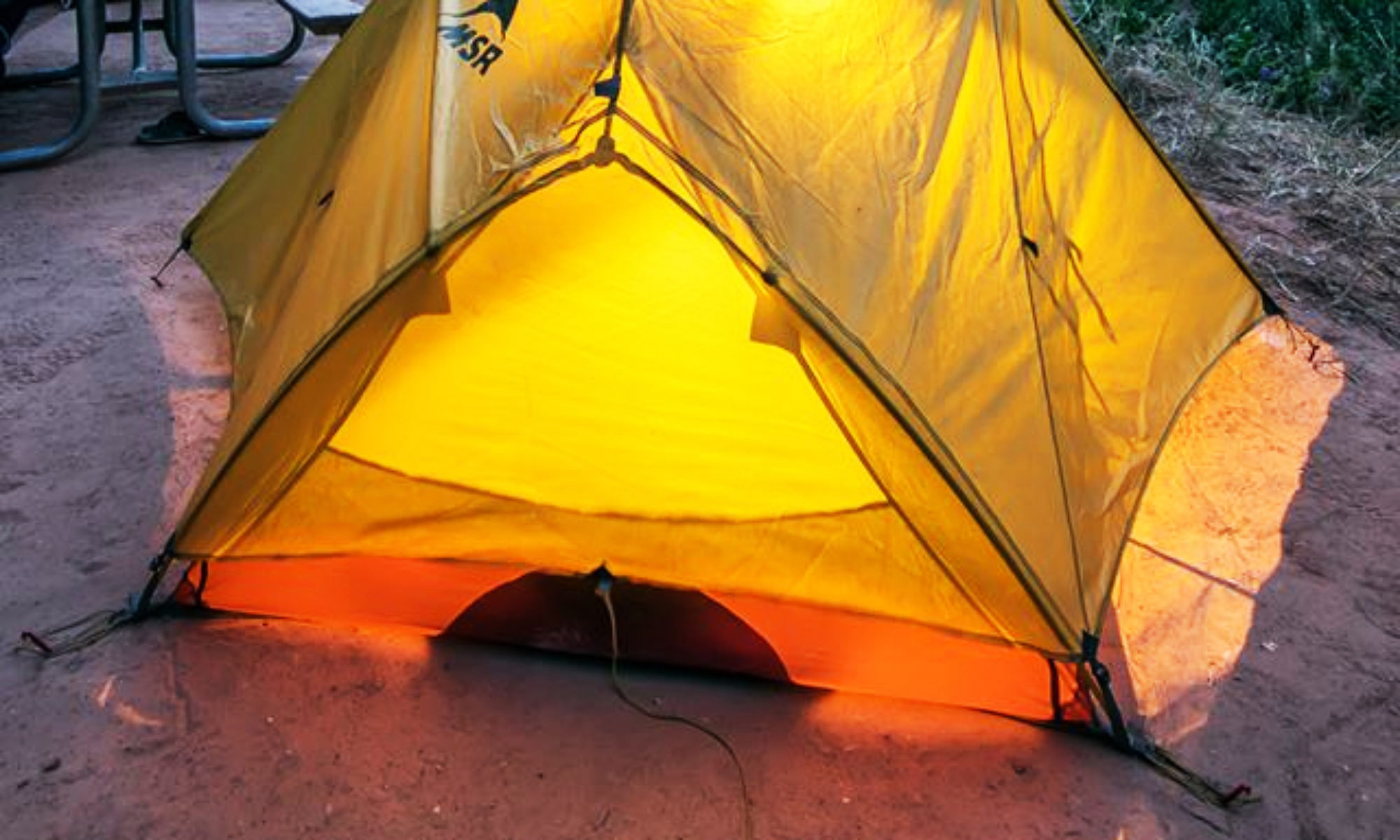
Below is a brief overview of my recent trip to Supai (9/1-9/4), and some pictures from my trip. Thanks!
-Jessica Rose
Hiking into Supai on September 1st 2018, the very first day the trail was re-opened to the public after July’s flash flood. I wasn’t sure what to expect. (For reference, my last visit was 11 months ago.)
Online, people have been speculating about what areas of this beautiful landscape, have been noticeably affected by the flood waters, the trails, waterfalls, campground, Fern Spring… what might be different?
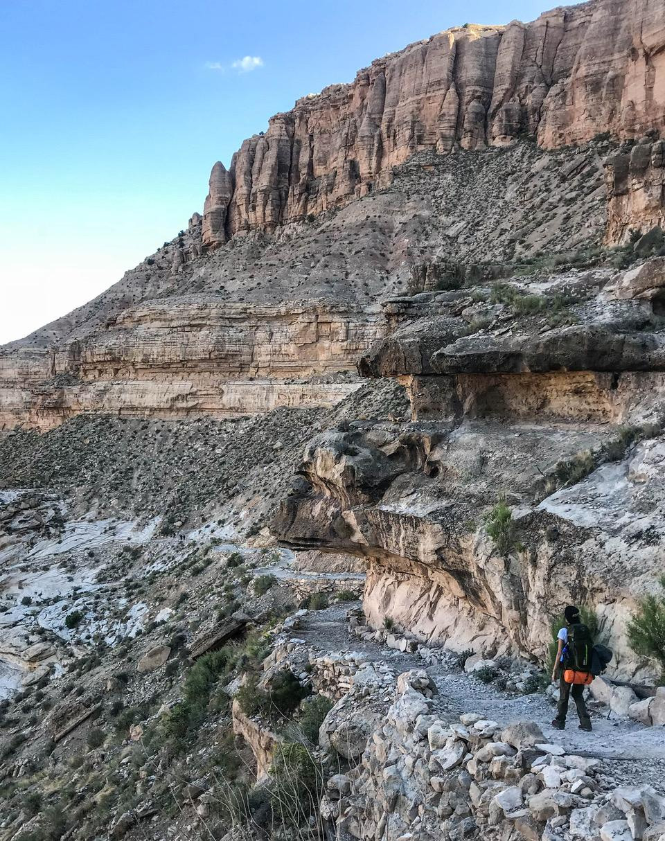
The beginning of the trail was slightly transformed. (some of the switchbacks had been washed out) I found the switchbacks were still just as delightfully steep and challenging, especially on the hike out.
The remainder of the trail to the village and campgrounds was fine, and along the way I spotted several people working on upkeep/ repairs.
The fry bread huts that were previously located at the beginning of the campground area, have been relocated to further up the trail. In between Lower Navajo Falls and Havasu Falls.

Thankfully, at least one stand was open every day of our trip (those of you that have experienced hot fry bread covered in Nutella or smothered in taco toppings after a day of hiking will understand the joy this brings).
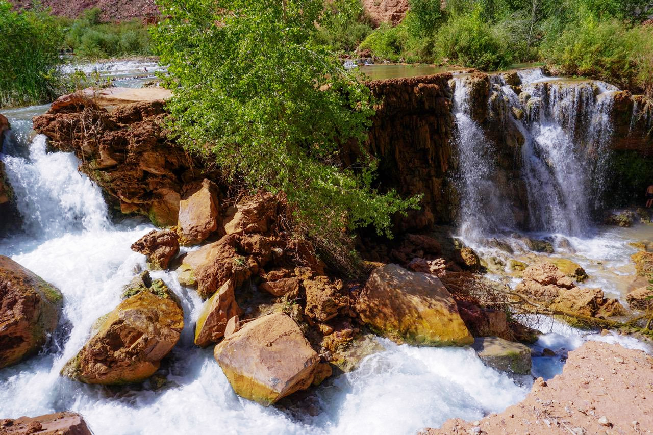
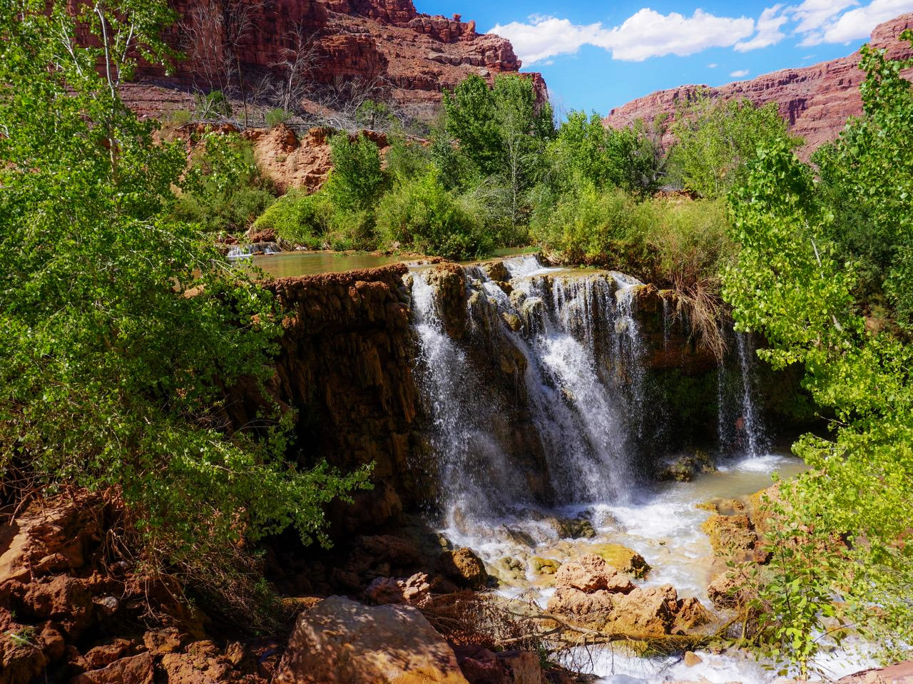
Lower Navajo Falls was the most noticeably changed feature in my opinion. With the flow of the water, and the rock formations, completely shifting around. The walkway down to the bottom of Lower Navajo Falls also was affected. Now a much more narrow path that drops off to the side.
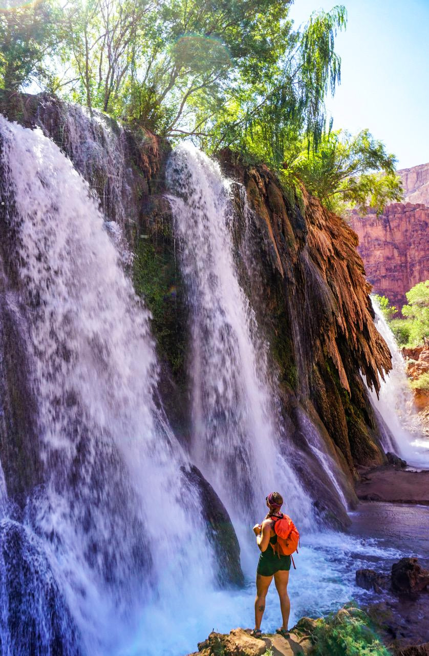
Havasu Falls remains as stunning as ever. The creek spilling into a perfect turquoise pool below, before flowing into smaller pools and cascading waterfalls.
50 FT Falls remains pretty much the same.
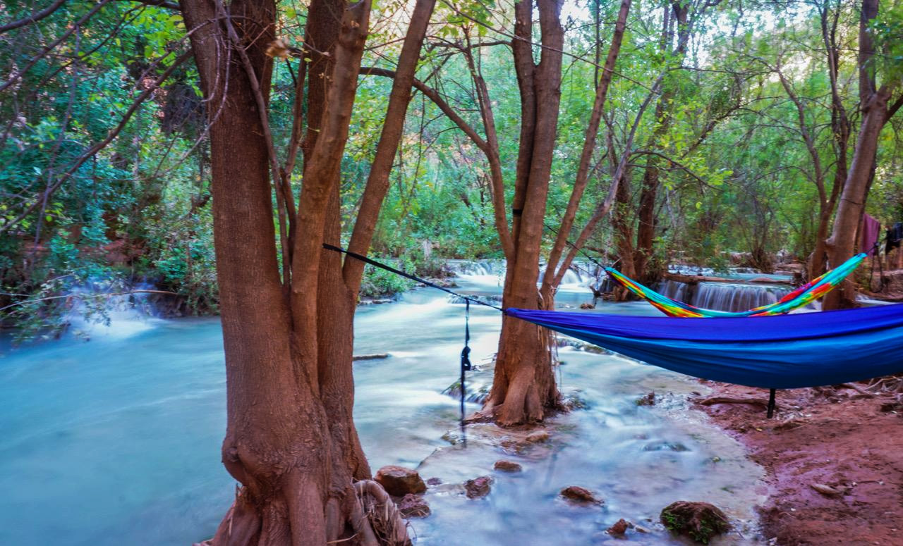
Overall the campground looks the same. The flow of the creek may be a bit different in spots, but nothing extreme.
The composting toilets were open and stocked with toilet paper and hand sanitizer.
The water from Fern Spring was clean and clear with no warnings posted.
In the campground I found a sweet spot to hang my hammock by the water. Throughout the creek, a fair amount of the reeds and other vegetation that lined the edges of the water, were flattened and dead. I am sure they will return to their former (and greener) glory soon!
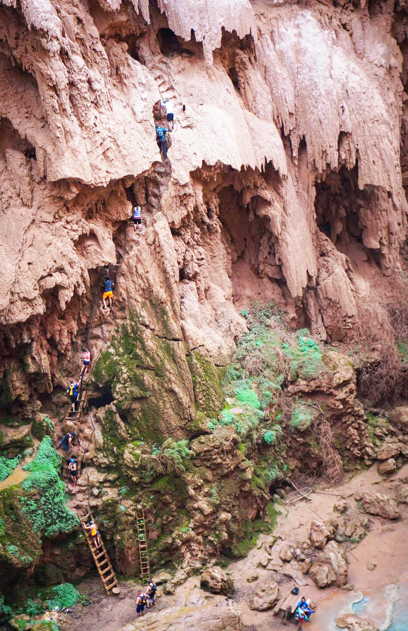
The climb down to Mooney Falls was unchanged- just as exhilarating as before. The only noticeable feature missing here was a picnic table that had decorated the shallower waters prior. Mooney Falls was it’s usual magnificent self. Its water pouring down and throwing mist over you as you climb down, the slick ladders and chains, to the ground.
The route to Beaver Falls, as well as to the Confluence of Havasu Creek, and the Colorado River, was accessible. In the past, it seemed there were more markers and cairns to help find your way. Lacking these, made the trail tough to follow at times, which resulted in a bit of backtracking to stay on course (this was mainly an issue after Beaver Falls, continuing on to the Confluence).
A tour guide also advised me that a ladder/rope had washed away from upper Beaver Falls, causing them to have to go back and take a different route. That means climbing the ladder up onto the cliff (facing downstream this would be on the right side) beside the palm tree instead of crossing the creek and proceeding downstream river left.
The river right ladder causes you to arrive at the lower point of Beaver Falls. Opposed to arriving on top of the falls, should the, river left route, have its ladders intact.
The changes caused by the flood certainly don’t impact the overall stunning vistas and imagery offered here in the Canyon. If anything, the changes added to the experience. A reminder of nature’s raw power, and ability to alter that which seems immovable.
To reassure those that are wondering… yes, the water was still very, very blue.
![]()