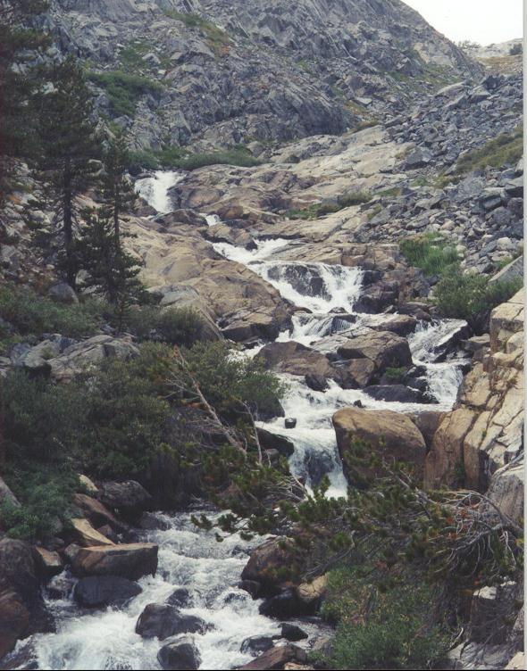
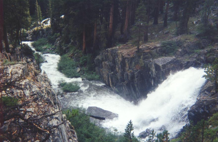
Despite the best planning and experience, Mother Nature can alter an adventure trip, or perhaps kill you if luck is not on your side. This is a short adventure story of backpacking a section of the Pacific Crest Trail (PCT). In the Ansel Adams Wilderness. Near Mammoth, California. Between the trail head at Agnew Meadows and Thousand Islands Lake.
Early in 1998 (I believe I have the year correct) I started planning some type of backpacking adventure. Two varied choices interested me. Backpack a part of the Pacific Crest Trail (PCT), or Backpack the Zion NP Narrows. Not new to camping or backpacking, I knew either would require advanced planning, permits, etc.
Most of my life, while living in the mid-west, I had dreamed of someday hiking a portion of the Appalachia Trail. But life tends to throw other priorities at you. You know, normal stuff like a job, a family. The grind of ordinary living, consumed the deposit of days in the bank of life. It was difficult to break away to indulge.
Equally difficult is to find a willing partner with corresponding available time. The dream faded as years went by. My only experience of trekking through relatively untouched mountaintop forests would be reading articles on the subject. Or replaying some memories of younger years while living in Montana.
In 1995 I made a life altering move from the mid-west, to Las Vegas, Nevada. I started spending many weekends, and week long vacation visits, at Zion National Park. I hiked to different places within the park, with each visit I made. I once headed upstream through the “Narrows”. I went several miles. What starts out as a well maintained trail eventually dumps you into the stream (Virgin River) of the Bottom section of the Zion Narrows
The Zion Narrows
During regular weather the water is clear flowing, cold, and knee deep in many places. It is swift enough that a walking stick is handy to maintain your balance. Many of the stones are rounded grapefruit size, and slick. It is easy stumble and go down if you aren’t paying attention.
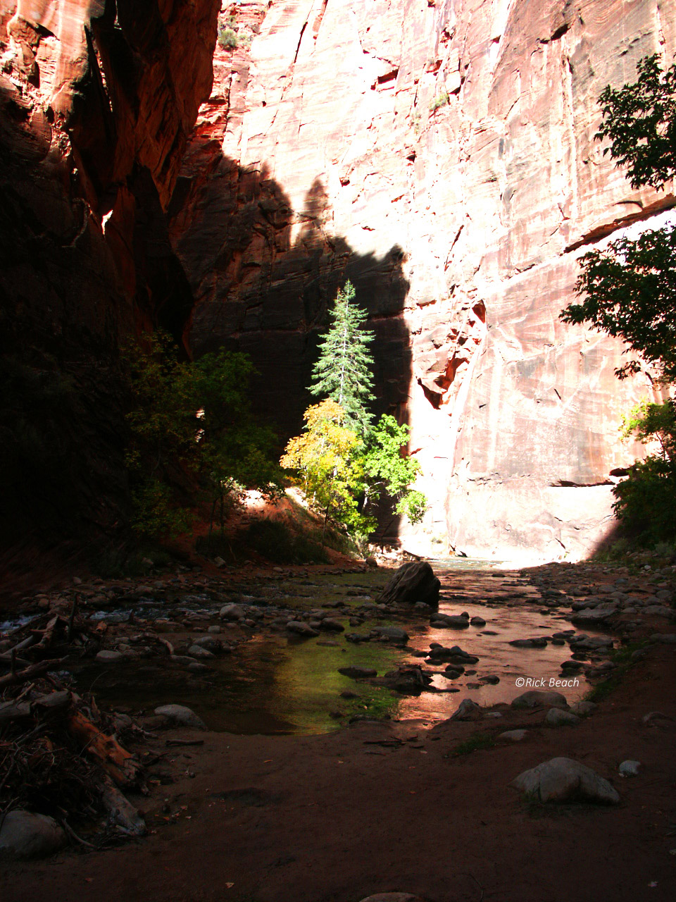
I was intrigued that it is also possible to be shuttled upstream some 16 miles or so, to enter the canyon there. Then hike/backpack 16 miles downstream to the point I had started. The canyon is narrow with high walls cut through many shades of colored sandstone. It is a wet trip, often times in chest deep water. There are deep pools, waterfalls, and a large risk of Flash Floods. During flooding there is sometimes no place to escape.
Another destination I would visit from time to time, from Las Vegas, was the Mammoth, California area. This was at a higher elevation, cooler summer temperatures, and covered with beautiful large pine trees. There is abundant water in the area. The area is littered with Alpine lakes and rushing mountain streams.
As the year started to get away from me I knew I had to make a choice. Permits might be difficult to secure in the more popular weeks. I couldn’t find any of my camping or hiking friends that were willing or able to go. While I know it is not advised to go solo, I knew that might be the only way I would go. With that in mind I looked at the two destinations. I held out hopes of someone accompanying me. I researched extensively on both possible destinations. I even contacted people that had made the Zion Narrows trip. That trip can be treacherous, and no one recommended solo on this 16 mile trip. Plus I had doubts I would be able to secure a permit as a solo trekker even if I was determined enough to attempt it.
The Pacific Crest Trail (PCT)
I focused on the PCT (Pacific Crest Trail). A small portion of it anyway. I knew there was a trail head located close to where I had camped previously, near Mammoth, California. Research indicated I could get onto part of the trail, by entering Ansel Adams wilderness. I secured 2 permits for September. Still hoping someone would be able to make the trip with me. Recommendations were against going solo on this trip as well.
September was much later than I wanted a permit for. But I had read mosquitoes are really bad in the summer anyway. I thought late August would be best. I tried for late August but permits were not available. September ended up being my only choice.
It was exciting, knowing there was at least a broad plan. Half the fun of any adventure is all the planning, prepping, and buying gear, etc. There was all summer to plan, and do conditioning hikes.
A gear check list was put together. Some lists existed from previous trips, modifications were made, and suddenly the plan started coming together.
One requirement the Park service insisted upon was a bear proof food storage container. That little voice of reasoning in your head that warns you not to do something was starting to talk to me…but the trip must go on!
I did read the bears could be bad. I had experiences camping in some of the State Parks around the Mammoth area to know they come into camp. I had seen them actually come walking through looking for food. Those camp grounds have steel food storage boxes at each picnic table…hmmm that voice again!
I found the required bear proof storage container, but was not happy with the additional weight. Thinking there was good cause for this being a requirement, the container was put into the “to go on the trip” pile.
I had recently purchased what I thought was the latest in high tech gear at the time (1998). A carbon fiber external frame backpack seemed be a good choice. By today’s ultra-light standards, this pack was the weight of an armored tank. Dry (unfilled), the pack was 8 lbs. I proceeded to trick it out with sewn on straps with attached quick release female buckles. For various pieces of gear I had nylon gear bags made with the male portion of the quick releases attached to the bags. I wanted easy access to gear such as my water filter, rain gear, etc. The pack had all types of external zippered pockets, so the final setup was extremely functional.
For years I had used some of the first generation GPS devices. I was comfortable navigating with them. I did not have a user friendly model that is widely available today, with colorized topo map software loaded. Mine was a more simple stick map of a trip, with a backtrack feature.
I had used compasses in the past, but never trusted my skills. So I made it an objective to carry both. I didn’t want to totally depend on the GPS in case of electronic failure, or dead batteries. I purchased a USGS Topo map of my local area, as well as a USGS topo for the section of Ansel Adams PCT I would be backpacking. Without a doubt, I recommend these maps on any back country backpacking trip.
At the time of my trip, the topo maps did not have any GPS coordinates on them to pin point, points on the trail. At least not the ones I purchased. I sat and plotted points by drawing grids of latitude and longitude. Then marking waypoints at 1 mile intervals.
I practiced with the compass in my local area until I was confident with both devices.
The easiest way of getting lost is not trusting your readings and thinking you know where you are. You have to have the confidence to know you know what you are doing.
I spent hours looking over the Ansel Adams map. Setting my objective and plotting my trip. I plotted one mile interval “waypoint” marks. I pre-marked these on my map, with the Latitude and Longitude, so I would have a quick reference to my GPS readings along the way.
I then loaded them into my GPS. I had a trip objective of give or take 12 miles one way, 24 miles round trip. Heading north on the PCT, to Thousand Islands Lake. Spend some time in the Lake area, to then return to my vehicle a few days later.
There was actually a choice of 2 trails. I plotted my route in, using the upper trail that looked over the valley and onto what in person I would see as breathtaking distant Mountains.
My return route would be on the valley floor, following the fast flowing San Joaquin River (saen wa:’ki:n/)
Concerning maps, GPS, and general navigating. I might add that at one point on the actual trip. The trail did not seem to be anywhere close to accurate with the paper map. Rather than freak out I checked my next waypoint a mile in front of me. I was generally heading in the correct direction. Map, GPS, and real trail, all eventually came together in that mile of hiking.
I knew I always had the option of backtracking had this not resolved itself and start making sense again. I suspect the worn trail had changed for some reason since it was originally documented on the map? If a person was really OCD in certain ways, that situation might cause some anxiety. Even panic if you dwelled on it too much.
In preparation of the trip, throughout the summer, I hiked many miles with 50lbs of books in my pack. I knew I would be doing 8 to 10 mile days on the actual trip. Also at a much higher elevation than I was used to. The difference between working your lungs and heart at 2000 or 3000 foot elevation is much different than at 8000 to 9000 feet. On top of that, a heavy pack makes everything more difficult.
“A long story short”, concerning my pack items and weight…. it can be summed up in two words, “TOO HEAVY“. When I hit the trail head I had 60lb of pack weight and another 7lbs of water. Nothing was ultra-light, and I would pay the price during the trip. In hind-sight I would have done things way different. In comparison, on a 2011 backpacking trip I had a 24lb pack (minus water) for a 5 day adventure.
September, and the anticipated trip, came around slowly. As the trip neared I knew I would be doing this trip solo. Not something I advise. I am sure it is not recommended by anyone with any sense. But some things in life you just want to experience may never happen if you wait for everything to be right.
I looked at it knowing the risks, and saying, should something unfortunate happen, it would at least happen while doing something I loved. Though I knew I was mentally and physically capable, I also knew one miss-step could result in a broken leg, sprained ankle, or some other serious injury. Due to the remoteness of the area, anything serious could definitely prove fatal.
September in the southwestern area of the US, especially the Las Vegas area, can still be what most people would refer to as “being in the dead center of summer”. After living here over 20 years, it still fakes me out.
No exception the year of this trip. As I remember the temperature was still hitting around 100 degrees in Vegas. I started packing gear, checking items off my gear list as I fitted my gear into my pack.
Hindsight would prove I failed to compensate for the huge difference in Alpine temperatures verses the desert climate I lived in.
My clothing consisted of one pair of cargo shorts, a couple changes of socks and underwear, two T-shirts, a hooded sweatshirt, well broke in hiking boots, and full rain gear.
The oversight of not taking warmer gear, and especially long pants, would give me a stark reminder while on the trail.
Other than that, I don’t recall not taking something I should have had. True to my nature I am sure I had things I could have lived without. I made many mental notes along the way of things I should not take on the next trip. With water I would be hauling nearly 70lbs on my back. I had planned on going 5 days.
I had campground reservations for Agnew Meadows. I started out from Vegas for the 6+ hour road trip to Mammoth, California. Time passed quickly since the drive is through a variety of regions and terrain. Desert, mountain passes, streams…. beautiful scenery.
Later in the afternoon I came rolling into Mammoth from the south. The scent of pine trees and fresh cool air, drifted through my truck. The smell and air temperature reinforced why I was here. I sure wasn’t missing the 100°F temps of Las Vegas.
It still didn’t sink in about only having shorts and no long pants!
I stopped in town and gassed up my truck. I secured a temporary fishing license, and had a bite to eat. The surrounding mountains with exposed rock outcroppings and greenery of pines trees thrust up from all views was stunning.
At the time, access to the campground was limited. I imagine there are still restrictions. Probably even more? It has to do with the road access.
You must take the Devils Post Pile road a short distance to pick up a gravel road into the campground. The issue is with the Devils Post Pile road. During certain hours you are only able to travel the road via the shuttle bus. It is Park Service rules and even notated on maps.
I timed my arrival for after the restricted hours and drove in with my personal vehicle. I planned to camp that night in the back of my truck, and then hit the trail at first light. The campground was rustic and rather remote. I saw one other vehicle and no people.
So my first night was to be spent sleeping in the bed of my pickup. I at least had the luxury of a camper shell to protect me from the elements. At an elevation of around 8300 ft the weather was far from the blistering heat I had left behind in Vegas.
The weather report indicated worse weather would be moving in later tomorrow. Shadows cast by the western mountains and ridges, brought with it a chilling breeze. Dusk coming fast. An indicator that autumn comes much earlier in the mountains. I enjoyed the views as long as I could, and then climbed in the back of my truck to snuggle down in my warm sleeping bag.
Through the night the cold crept in. I adjusted the bag to remain warm. It was much colder than I had expected. It was so cold that there was no way I was getting out of the warm bag in the wee hours of early morning to answer the call of nature. Of course anyone having experienced that urge verses a warm bag. Knows all too well you really can’t sleep well after it hits you.
It was just beginning to get light. I noticed the condensation of my breath was frozen on the windows and the inside of the camper shell creating abstract crystal etchings. It was below freezing! I wanted to start at first light, so I guess this was as good a time as any.
I rolled up my sleeping bag and cinched it down using the custom strap installed on my pack. I now realized long pants and another layer for the top should have been on the check list. I had on a hooded sweatshirt, but shorts made it a bit cold. I headed off for the trail without taking the time for breakfast.
Note: I learned a valuable lesson and pause here to pass it on. On any trek such as this. Carry additional clothing/gear that you can adjust at the last minute, at the trail head. If you end up not needing it, no loss. It remains behind in your vehicle.
My plan was to hit the switchbacks just outside the campground and head up to the high trail. I figured by the time I reached the top the sun would be up. The elevation gain of nearly 2000ft would certainly warm me up. Breakfast would wait.
The switchbacks were difficult as expected. Especially with the heavy load I was lugging up the incline. The trail eventually leveled off, and followed a steep ridge that fell off toward the valley below. By this time I was not only warm, but overly warm. The sweatshirt had long ago been shed and lashed to the pack. I was down to a sleeveless T-Shirt and shorts. Loving life!
This section of the trail is wide open in places so the sun was warm. The sky was patchy blue with clouds drifting toward me. The clouds flowing around the peaks resembling giant glaciers . It wasn’t hard to also imagine the clouds as water in a stream, flowing around rocks. It was a beautiful day.
It was time to shed the pack for a while and brew a cup of coffee. Take time for some breakfast. The view through the pines, to the distant mountains was awesome. I lay on the ground propped up against my pack and enjoyed breakfast with that killer view.
There were patches of snow, exposed granite cliffs, vivid green pine trees, and small Alpine lakes in several directions. From the Topo map, I knew the San Joaquin River snaked its way through the valley floor below me, but the tree cover hid it from view.
The finest restaurant could not come close to providing the experience I enjoyed in this moment of time. I lay on my back, propped up against my pack, the view, the clean pine air….I just breathed it all in. That was one of the best cups of camp coffee I might ever have. The nap in the warm sunshine wasn’t bad either.
The solo experience was enjoyable. It gave me lots of time to reflect on things of the past as well as those of the future. There was no responsibility of worrying about anyone, and no time table to meet. I just had to make it back to the truck in 4 or 5 days.
I was heading north on the PCT toward Thousand Islands Lake. At this point nearly all expectations of the trip had been met. My vision of the coming days was to make the lake, then break out the collapsible fishing rod and reel. I wanted to try for some trout.
Another dream was to dive off the rocky shore somewhere, to rinse the sweat and trail dust off me. At this point I imagined the water temperature would be slightly above that of melted snow…brrr! After last night’s temperatures I was having second thoughts about that vision. Maybe a little stinky is OK?
The first day nearly over, found me at the point where the San Joaquin River falls out of the lake. There was rushing white water, cascading on its way down a steep incline, to the valley river below.
I had actually come farther than planned for the first day. My hips certainly knew it. That heavy pack really took its toll on my joints. My knees, hips, and lower back were killing me. Even with all the conditioning I did, I was hurting now. Once I took the pack off that time, I knew I was done for that day.
It was late afternoon anyway. I had carried a gallon of water. Something that wasn’t necessary since I found adequate water sources everywhere, along the trail. So as the sun disappeared over a distant peak, I pitched my tent and laid out my sleeping bag, and made a hot meal.
That anticipated afternoon weather, had rolled in. It brought with it heavy clouds and a drastic drop in temperature. I could smell the rain that was on its way toward me. I started seeing flashes of lightning and the distant rumble of thunder. The interval between the lightning and the thunder was beginning to shorten. I counted the seconds between the flash and the boom. I knew the storm would be on me soon. I had my rain pants and jacket on by now. More for an added layer of warmth at this point. I enjoyed a small warming campfire.
A cold rain started to fall as I finished up my evening meal. I stashed all my food, toothpaste, soap, etc in the bear proof container, and then strung that up in a distant tree. I didn’t want any bear visits to my tent in the middle of the night. Just before winter they are trying to fatten up and looking for anything to satisfy that instinct. I was beginning to think the bears might already be heading for hibernation with as chilly as it was. I could only hope!
The storm was nearly on me now. Some of the thunder was right on top of the flash. The thunder was kind of scary. Spooky the way it echoed. I never experienced a storm in the mountains sounding quite this way. I quickly made a deeper trench around my tent to divert water, and then made a last check for dead branches above me. I had selected a location that was sheltered by some large rocks.
I doused what was left of the short lived campfire.
I crawled in my tent and un-lashed my wet boots. The thunder was booming around me. I stripped off my clothes and pulled the sleeping bag up around me. Everything felt damp and chilly.
The lightning and thunder passed rather quickly but the rain was coming down hard. It didn’t sound as if it would stop soon. It was pitch black by now. No moon or starlight because of the heavy cloud cover. I fell asleep listening to the constant patter of the rain drops hitting the tent.
The cold woke me sometime near midnight. It was now silent except for the gurgle of the river which was nearby, rushing over the rocks on its way downhill. My sleeping bag was rated for zero degrees. I had it zipped up all the way and was having a hard time keeping warm. My guess was it was in the low twenties or high teens. During the last few hours of morning darkness, I had slept enough I couldn’t drift back to sleep. But I remained in my bag for its warmth.
As dim light let me look out and start to make out objects, I saw why the rain drops had stopped. It had changed to snow somewhere in the night. The ground was totally blanketed in several inches of snow. Man was it cold! I got up to make some coffee to find my water frozen. I scooped up some snow and fired up the stove. The stove even seemed reluctant to work. The altitude probably didn’t help either.
The sun was just coming up now and the snow fall started changing back to rain. I was in full rain gear and my sweatshirt trying to stay warm. I had just finished my coffee, when it started a heavy downpour of rain.
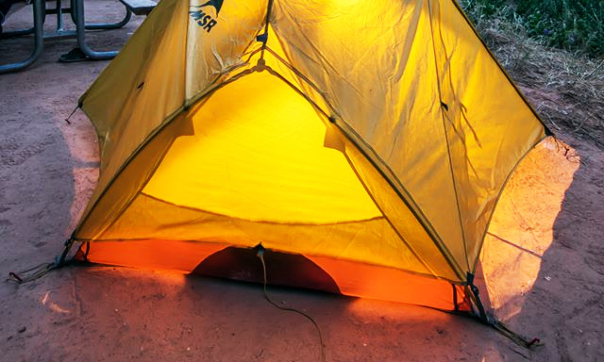
I climbed back into my tent and back into my sleeping bag to wait out the rain. My tent wasn’t really high enough to comfortably sit up. I turned to look out the screened flap. Thankful my tent at least had a small overhang to keep the falling rain out. For the longest time I lay there and watched rivers of runoff water stream past. Channeling through the trenches I had dug. It is funny how your mind wonders, to other thoughts. As a little stick floated by, I thought of a little boy playing in a gutter of rain water with a homemade boat.
Rain was coming down hard and didn’t appear it would end anytime soon. The morning wore on with a continuous down pour…..this wasn’t enjoyable. Being cooped up in the small tent was beginning to be claustrophobic. The humidity was making everything feel wet. I now focused my concern on perhaps an even colder night. With things as wet as they felt, it might be a mistake to stick with the original plan.
The rain had long ago washed away the snow in my immediate area. I could still see snow on the other side of the river, in the tucks of rocks. But I had seen that yesterday before the rain had started. As it rained steady most of the morning, I neared a decision I was contemplating.
I calculated I could move fairly quickly back to my truck if the rain appeared like it would not let up. I thought I could make it in 4 hours if I lightened my pack. That would give me an extra hour or so of daylight as a fudge factor. One problem was, I intended to take the lower River trail back. Not the High trail I had used to get to this point. I wasn’t sure of anything since I had no concept of the trail.
At this time the lower trail only existed as a plotted line on my topo map. I knew the distance but not the difficulty. Topo map elevation lines, seemed to indicate it might be easier. About 12 trail miles back to my truck. It was about 10am at this point. I was going to make the final decision around noon.
Noon rolled around as the rain continued to fall hard. I separated gear and food I was going to leave behind. I kept the essentials in case I got stranded in the dark on my way back. I might have to sleep the night in the woods, along the trail.
I buried the rest of my food and gear, rolled a large rock on it, and then made a waypoint on my GPS of the location. Should the rain suddenly stop, I thought I would return and continue back on the original plan.
I headed off downstream. I was in full rain gear, and under a full cold downpour. I had dumped my water. Water was all around me at this point. In fact, it was even making it through my rain suit in places. My boots and socks were squishing wet. If I got caught in the dark and the cold, it would not be a fun night.
The river was beautiful. I passed through what looked like a camp people had used with pack horses? It is funny the things that catch your eye. This trail was more defined and easy to follow than the higher trail.
I plotted my position several times with my GPS against my topo map. I could see my “backtrack” route of the high trail on my GPS when scaled out to a broader range. That trail was 1000 to 1500 feet above me at times.
I could tell I was making good time and my GPS ETA to my truck waypoint was right on, indicating a 4pm arrival. The rain never let up. Rainwater was streaming down my face, and down my neck. Part of it could have been sweat? Moving as fast as I was, even as cold as the air temperature was, I was warm. My feet were warm too, even though soaking wet. I knew I couldn’t stop for any length of time though. Or I would sure to chill rapidly.
I kept thinking it would be a miserable night should I get stuck on the trail and have to spend another night.
I stopped briefly several times to pump water through my filter, then drink to keep myself well hydrated.
The GPS continued to show my ETA on schedule. In fact I had picked up some time along the way. I was feeling a little relief as the distance started to close. I was wet and hungry, but wasn’t going to stop until I was made it to my truck.
To my enjoyment, my GPS finally started beeping. It was indicating I was within 500 feet of my truck waypoint. I couldn’t see the truck at first. I didn’t even realize I was that close. I was coming in from a different direction from what I had left. No one was around and the rain was still coming down. Then I saw my truck, tucked in, on the other side of some trees. What a welcomed sight!
I threw my rain soaked gear in the back of my truck. I then started the truck engine to get the heater going. I proceeded to strip off my wet clothes. I had steam rising off my warm wet body. There was that much of a temperature difference…..or it was that cold.
The rain was near the point of changing to snow again. I had a dry set of clothes, as well as dry shoes, stashed in the truck. After I dressed, I just sat there with dry clothes, the heater running, and gazed across the valley toward the mountains. They were difficult to make out. The tops completely engulfed by clouds. The mountain bottoms barely visible through the gray of the heavy rain.
What an adventure. But glad I listened to my little voice of reason this time, and cut it short.
That night I spent sacked out in a warm hotel room in Mammoth, California. I woke up to rain once again. I enjoyed the decision of abandoning the trip. I had a relaxing breakfast and coffee. I then hit several of the local sporting goods stores in town, to buy a warm pull over. It was still cold. I enjoyed most of the morning visiting different places around the small town of Mammoth. I then climbed in my truck and heading back toward Las Vegas.
As I neared Vegas, the cold and rain had disappeared behind me. It was sunny again and I had to flip on the air conditioner. Though I never reached the exact final destination I wanted to make, nor catch that trout I wanted to get. I had an adventure that I will never forget. An adventure through a section of wilderness many will not even attempt. I also knew it would not be my last adventure.
When I returned to Las Vegas, I was reading the newspaper and an article of flash flooding in the Zion Narrows. With a concerned half smile, I thought of the fact I could have been at Zion instead. I nearly was, given another chain of events.
On the positive side of things …I have to think I was fortunate. Just plain lucky I was in the wrong place, at the right time. I was wet and cold but lived to remember the trip. Several tragically drowned in Zion Narrows during that flash flood.
It has been many years since this trip, and I think of it often. I just hope someday I run into another adventurous soul that would like to try that trip.
![]()
